Tracce GPS:
– File.gpx
– File.tcx
– File.kml
(Come scaricare tracce GPS)
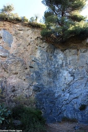
Itinerari presenti: 10
Difficoltà: da 3b a 6a+
Lunghezza itinerari: fino a 10m
Fonte: http://www.finalebythomas.com Dove potrete trovare maggiori informazioni tecniche
By car (from Finale Ligure’s train station FF SS): you take the first way out to the right in the roundabout and you drive on the national road Aurelia (Strada Statale SS1), direction Ventimiglia. You go beyond the tunnel and the straight road between Finale Ligure and Borgio until you reach a traffic light by a railway crossing. You turn right, crossing the rails and then you turn right again through “Via Verezzi” driving about 150 m. You take now, again, the road on your right side “Via della Cornice” traveling for 500 m until you reach an unpaved road. Here you can park your car. (Drive back until the city center if no car parking is available).
Total length of the car route: 3.6 Km
Walk for about 450m on the unpaved road to reach a big crossroad. The trail to the right leads to the crag.